 Fastest
By plane
The quickest way in
- Arrives
- Comandante Armando Tola
- Flights
- Daily, domestic
- Best for
- Short trips
Language
EnglishCurrency
US dollar · $GetYourGuide shows prices in the currency you choose.
Guide · Getting there
El Calafate is remote, but well connected: an international airport, long-distance buses from Argentina and Chile, and a paved road from Ruta 40. Here is how to get to El Calafate, and on to the glaciers.
Editorial team, elcalafateglaciertours.comUpdated October 16, 2026about 6 min to read17 sources
For a long journey, flying is the quickest way to reach El Calafate. Comandante Armando Tola, the airport serving the town, has flights every day from elsewhere in Argentina, with seasonal services from abroad as well.1 Domestic connections usually run through Buenos Aires, and the timetable changes between summer and winter, so check the current routes when you plan.
The airport sits on the steppe east of town, with the lake and the mountains filling the windows as you land on a clear day. Taxis and shuttle buses wait for the flights, and many hotels can arrange a transfer if you ask in advance. The ride into town is short, and it is a good moment to get your first look at Lago Argentino.
Book flights early for the summer months, since seats fill quickly in high season. If your plans include the north arm boat or an ice walk, avoid flying in on the morning of the excursion. Give yourself a buffer: Patagonian weather can delay flights, and arriving the evening before is far less stressful.
On arrival
Landing
Daily flights from other parts of Argentina.1
Into town
A short ride across the steppe.
Evening
Walk the lakeshore and check your bookings.
Next morning
Coach to the port, about 45 minutes each way.
On the water
The port is 47 km from town.5
Buses reach the El Calafate terminal from different parts of Argentina and from southern Chile, including Punta Arenas and Puerto Natales.2 For travelers combining Argentine and Chilean Patagonia, the bus from Puerto Natales is the classic link between Torres del Paine and the glaciers of Los Glaciares.
Within Argentina, the provincial capital Río Gallegos is a common starting point: El Calafate lies 316 km away.4 Buses there connect with routes along the Atlantic coast, and the ride inland crosses wide, empty steppe where guanacos and rheas graze beside the road.
Bring your passport for the border crossing from Chile and check the current entry rules before you travel. Buy tickets a few days ahead in summer, carry snacks and water, and keep a warm layer in your hand luggage: bus heating and the wind at rest stops both have a habit of surprising you. If you arrive late at night, book your first bed in advance and note the address offline, since the terminal can be quiet after the last buses.
Routes
| From | How | Distance | Note |
|---|---|---|---|
| Buenos Aires and other cities | Plane | - | Daily domestic flights |
| Río Gallegos | Bus or car | 316 km | Provincial capital |
| Puerto Natales, Punta Arenas | Bus | - | Border crossing to Chile |
| Ruta 40 junction | Car | 44 km | On RP 11 |
| El Chaltén | Bus or car | 220 km | Paved road |
Sources: the national parks administration and El Calafate's tourism office.14236
Compared
FastestThe quickest way in
 Budget
From Argentina or Chile
 Freedom
Decision helper
Tap your situation
Each day it welcomes flights from various places in Argentina, plus flights from abroad when the season allows.
Ruta 40, the legendary road that runs the length of Argentina, brings road trippers from the north and the south.3 From Ruta 40, the turn west onto RP 11 leads 44 km to El Calafate, and from there roads continue to the Perito Moreno walkways, Lago Roca and Puerto Bandera.3
Distances in Patagonia are long and services are few. Fill the tank whenever you can, carry water and food, and check road conditions before setting out. The park authority recommends checking the state of the roads, and in winter snow can make chains or studded tires necessary. Drive in daylight where you can: guanacos wander onto the road, crosswinds push hard against high vehicles, and the long straight stretches can make you sleepier than you expect.
A rental car gives you freedom on arrival. You can drive the 80 km to the Perito Moreno on RP 11 or the 47 km to Puerto Bandera on RP 11 and RP 8 at your own pace.8 Parking at the port is free if you join this site's tour with your own vehicle.
Map
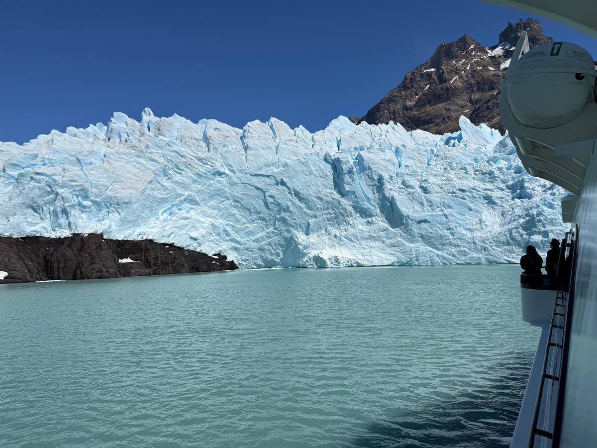
The town, the port where the glacier boats leave, the Upsala and Spegazzini glaciers, and the road north to El Chaltén.
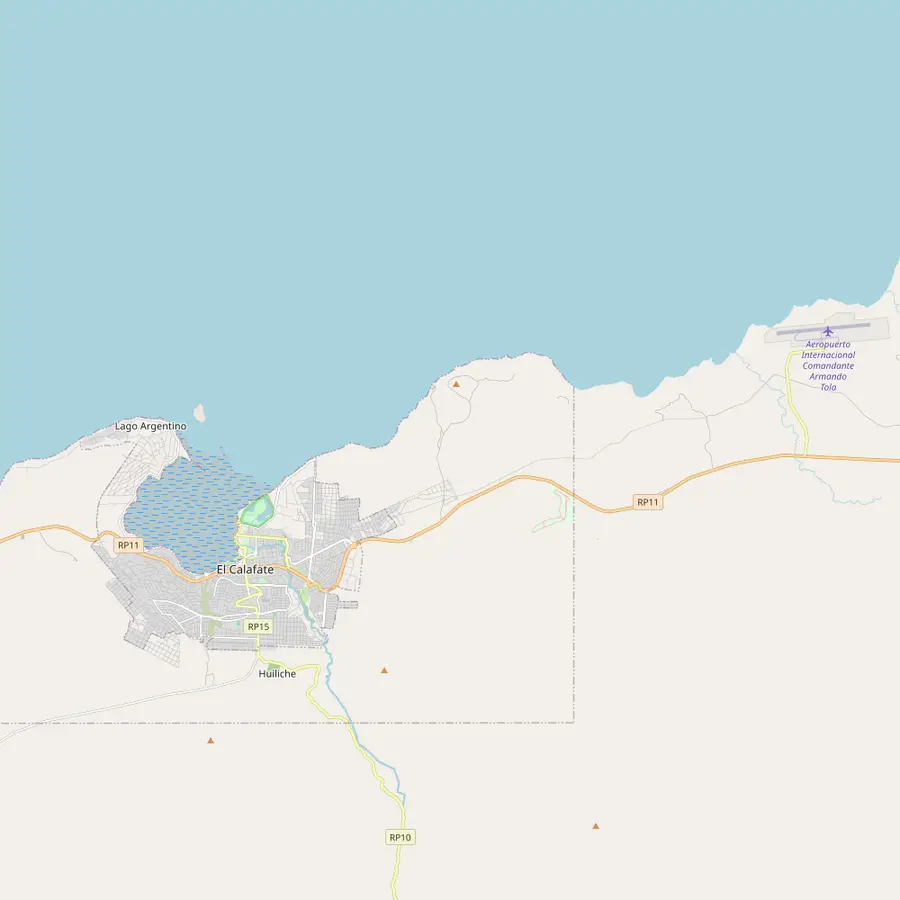 1El Calafate2Laguna Nimez3Glaciarium4Punta Walichu5Airport
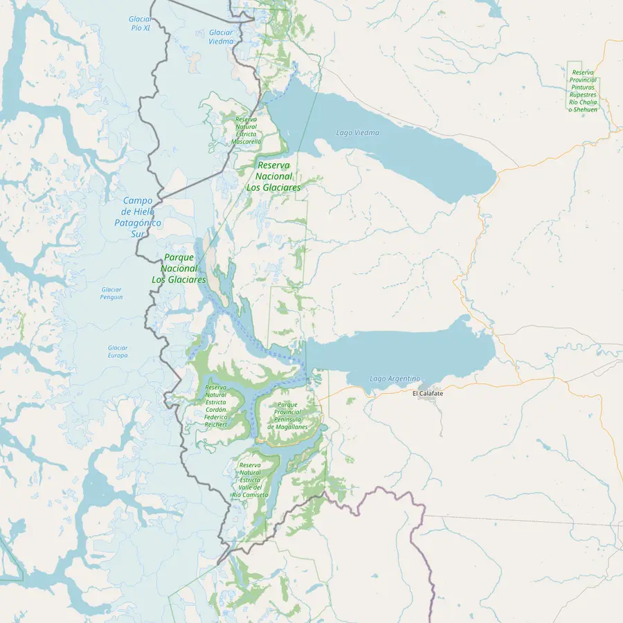 1El Calafate6Puerto Punta Bandera7Spegazzini8Upsala9Estancia Cristina
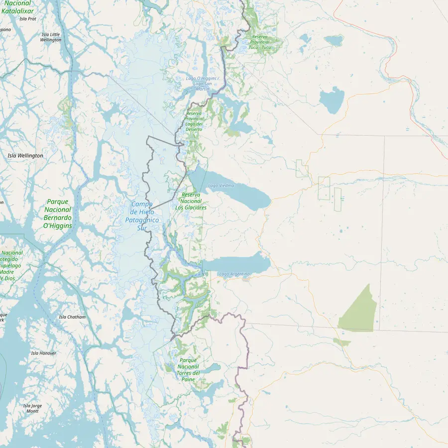 1El Calafate5Airport6Puerto Punta Bandera11Perito Moreno10El Chaltén
Base for the southern zone of the park: 47 km to Puerto Bandera and 80 km to the Perito Moreno by road.8
In Google Maps ↗A municipal reserve at the edge of town with an interpretive trail.9
In Google Maps ↗The ice museum the park lists among the town's sights.9
In Google Maps ↗An archaeological site close to town.9
In Google Maps ↗Comandante Armando Tola airport, with daily flights from other parts of Argentina.1
In Google Maps ↗Where the glacier boats leave: 47 km from El Calafate on paved RP 11 and RP 8.5
In Google Maps ↗The park calls it its tallest glacier; the operator gives its height as 135 m.1011
In Google Maps ↗The largest glacier on the boat route; its front retreated 7.2 km between 1986 and 2014.1012
In Google Maps ↗A ranch reached by boat through the Upsala arm, with views of the glacier.13
In Google Maps ↗Argentina's trekking capital, 220 km from El Calafate on paved road.146
In Google Maps ↗80 km from El Calafate on RP 11.8
In Google Maps ↗Checklist
Video
Until you tap play, the video stays unloaded.
El Chaltén lies 220 km north of El Calafate, all on paved road.6 Regular buses run daily between El Calafate and El Chaltén, and buses from other parts of Argentina reach El Chaltén's terminal as well.2 Many trips combine both towns, flying into El Calafate and taking the bus north after the glaciers.
A full-day tour from El Calafate to El Chaltén is sold from $117 for 11 hours, with pickup included and stops at Parador La Leona, the Mirador de los Cóndores and the Chorrillo del Salto waterfall, rated 4.44 from 1,003 reviews. It is a good choice if you want a look at the north without moving hotels.
If you plan to hike in El Chaltén, travel there by bus and sleep in the village. The classic trails, like the walk to Laguna de los Tres, take most of a day on foot, and arriving fresh in the morning makes all the difference.
Once you are in El Calafate, the glaciers are still a drive away. The Perito Moreno is 80 km from town on RP 11, and Puerto Bandera, where the north arm boats leave, is 47 km on RP 11 and RP 8.8 Without a car, buses, taxis, transfers and organized trips all cover these routes.
For the boat trips, the park authority notes that a transfer to the port can be hired if you have no car.7 This site's tour includes an optional round-trip coach transfer from El Calafate hotels to the port, about 45 minutes each way, and many day trips include pickup from your hotel.
Check the pickup details in your confirmation the evening before. Pickups often start early and work through a list of hotels, and being ready in the lobby a little ahead of time keeps the whole group on schedule.
The park recommends visiting between September and April.15 That is also the busiest time for flights and buses, and the town's tourism office advises booking accommodation at least one month ahead, and more if possible.16 Lock in your transport early once your dates are set.
From May to the start of spring, temperatures are low and snow is more common, which makes some activities and trails harder to reach, according to the park.15 Flights still run, and the town is calmer, but driving demands more care and winter equipment.
Whatever the month, wind is part of the trip. West and southwest winds prevail in El Calafate, and in summer they blow more often and harder.17 Allow for delays, especially on small flights and on exposed roads.
El Calafate is compact, and the center is easy to walk. Most hotels, restaurants, agencies and outdoor shops sit along or near the main avenue, and the lakeshore is a short stroll away. Take the first evening to get your bearings, change money if you need to and buy anything you forgot for the glaciers.
Use your arrival day for something light: the Laguna Nimez reserve, the Glaciarium ice museum or the Punta Walichu rock shelters are all on the park authority's list of sights around the town.9 Our guide to what to see in El Calafate has more ideas for a free afternoon.
Finally, check the next day's plan. Confirm pickup times, buy your national park ticket online if your excursion needs it, and pack layers, sunglasses and a packed lunch. A calm first evening sets up the rest of the trip. Then go to bed early: the glaciers reward travelers who start the day rested, and the light on the lake in the early morning is worth getting up for.
Book your boat day
Hold a seat today, pay closer to the date, and cancel for free until a day before.
Yes, an international one. Comandante Armando Tola receives daily flights from other parts of Argentina.1
Yes. Buses arrive from Punta Arenas and Puerto Natales.2
316 km. Río Gallegos is the provincial capital.4
Via Ruta 40 and RP 11. From Ruta 40, RP 11 leads 44 km west to El Calafate.3
By bus or tour. Buses run daily between El Calafate and El Chaltén, 220 km apart.26
By car, transfer or tour. The port is 47 km from town on RP 11 and RP 8.5
Early for summer. The park recommends visiting from September to April, the busiest months.15
Sources
Keep reading